
Ratisbon/Regensburg has grown tremendously since 1809, and is now a modern city with a population over 160,000. The town walls stormed in April 1809 have long since been torn down, to be replaced by a rampart-shaped belt of parkland around the historic city center. The built-up area now stretches over a vast semicircle to approximately 3 kilometers east, south, and west of the old walls. In terms of the Campaign Eckmuhl map, the village of Pentling, 56 hexes southwest of the Steinerne Brücke, is now separated from the edge of the city by just 500 meters of open ground. Karthaus Prüll and the Napoleonstein hillock, each about 30 hexes from the Steinerne Brücke, are now comfortably within the southern quarter of Regensburg.
A somewhat dramatized contemporary painting of Napoleon being treated for a light wound to his foot (bruised by a spent ball) outside the walls of Ratisbon, 23 April 1809.

The spot where Napoleon was wounded in the foot on 23 April 1809, outside the walls of old Ratisbon. Now, the intersection of Martin-Luther-Strasse and Hemauer Strasse. Looking northwest.
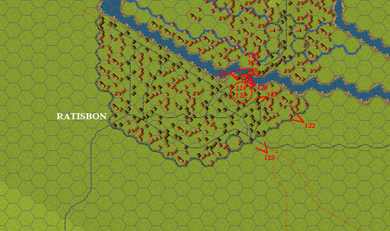
Reg123
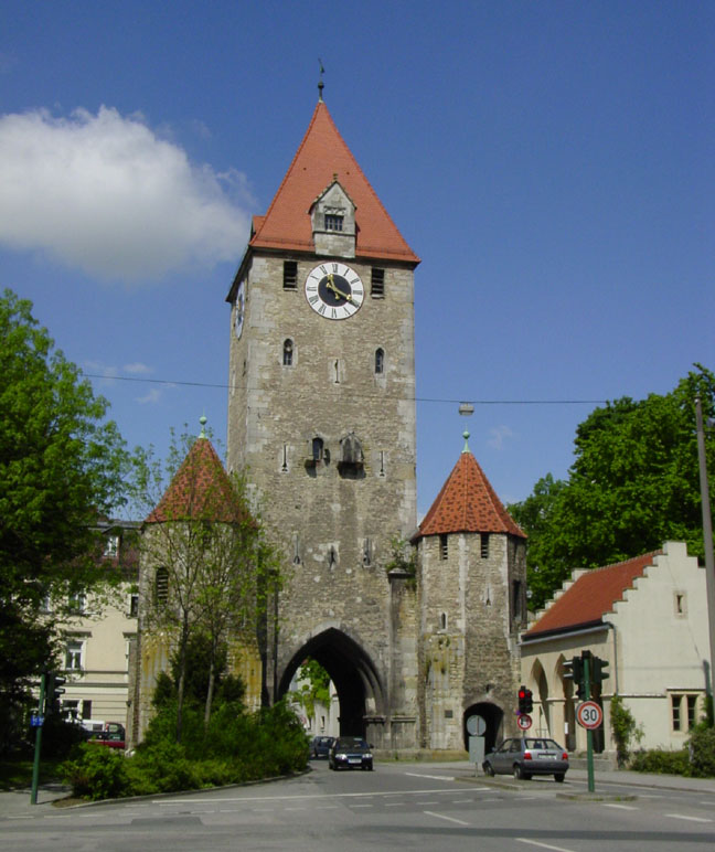
The Ostentor (East, or Straubing Gate) of the fortifications of old Ratisbon. Looking west from outside the old walls.
Reg122

The Steinerne Brücke (Stone Bridge) at Ratisbon, built in 1145. Looking west from the south bank of the Danube.
Reg120

Looking east (downstream) along the Danube from the Steinerne Brücke at Ratisbon.
Reg126

Looking southeast from the Steinerne Brücke toward the south bank of the Danube and downtown Ratisbon. Cathedral in background. The smoke in the right foreground issues from a stand selling fresh-grilled Regensburger Würstchen. Yum!
Reg127
Looking south along the Steinerne Brücke at Ratisbon.
Reg128

The upstream side of the Steinerne Brücke, looking northeast from the south bank of the Danube. "I have the honor to call your Excellency's attention to the fact that the bridge of Ratisbon over the Danube is a stone bridge, very fine and very solid, and that I have neither the materials nor the workmen to blow it up even in part." (St. Hilaire to Davout, 11 April 1809)
Reg129

Domplatz 6, the former townhouse of the Prince Primate Karl von Dalberg, Napoleon's headquarters in Ratisbon 24-25 April 1809. Memorial plaque in the center of the facade. The house is now used as an upscale carpet shop.
Reg124

The Porta Praetoria, Regensburg. This stone archway, built in 179 A.D., was the principal entrance of the Roman military settlement of Castra Regina. The Romanophile Napoleon, the New Caesar, very likely paused to gaze upon this artifact of an earlier Imperial glory, much as tourists do today.
Reg125

A surviving segment of the Roman town wall of Castra Regina.
Reg121
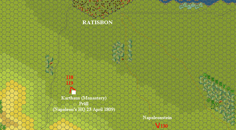
Photo locations south of Ratisbon
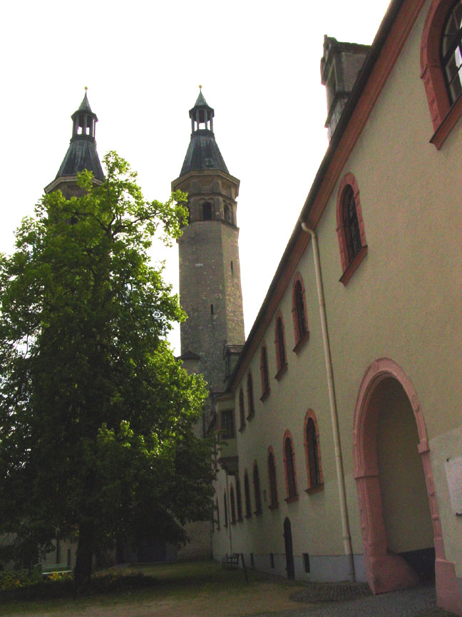
Karthaus (Monastery) Prüll, outside the walls of old Ratisbon, where Napoleon spent the night of 23 April 1809.
Reg119

Plaque on the courtyard wall, Karthaus Prüll.
Reg118