Quaama wrote:
I'm unable to research this in detail but offer the following observations.
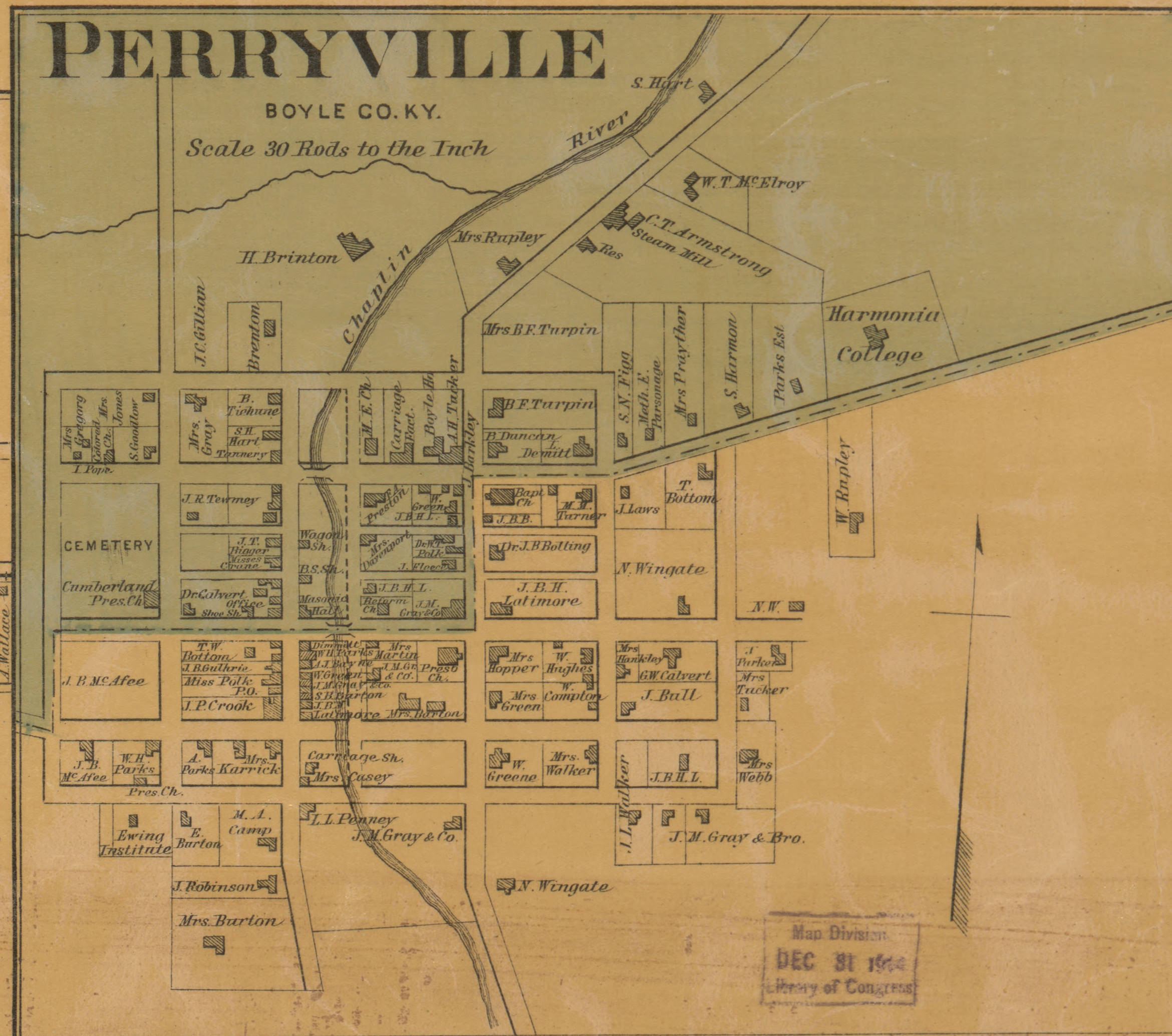
In WDS Perryville Hist I count 45 hexes. According to this map (
https://civilwartalk.com/attachments/1672265857214-png.461325/) the WDS maps looks about right in terms of the sprawl of Perryville. You say Perryville had a population of 400 people in 1862. Don't forget that in those days all the 'people' were not counted in the census. I understand that Kentucky had a significant slave population so there would have been a lot of inhabitants who were not counted as people although they would have still been housed.
....
Placing the map on the link in my graphics program I found Perryville to be about 1/2 mile wide and a little higher when compared to the Scale of Miles on the map.
That's @ 875 yards or 6-7 hexes of game map, horizontal distances have to be adjusted for the use of hexagons.
A hexagon that is 125 yards side to side (vertical) is 145 yards point to point (horizonal) so the original map would have to be adjusted to compensate.
So if this map was used as one of the sources that would explain the size of the town.
As to how accurate the online historical maps are, that is a question I don't care to get into at this time.


